clt currently has a dusting of frost
frost on cars and grass…
42 degree celsius here the other day. So i think thats 107 for use yanks over there.
I just bought 15 gallons of gas, 2 gallons of milk, & 6 loafs of bread. I’m ready for the Ice Age.
[QUOTE=moss2k;378033]I just bought 15 gallons of gas, 2 gallons of milk, & 6 loafs of bread. I’m ready for the Ice Age.[/QUOTE]
clt says that is not enough!
Just fog in my neck of the forest.
[QUOTE]URGENT - WINTER WEATHER MESSAGE
NATIONAL WEATHER SERVICE RALEIGH NC
359 AM EST MON JAN 19 2009
WINTER STORM WATCH IN EFFECT THIS EVENING THROUGH TUESDAY AFTERNOON FOR ALL OF CENTRAL NC
NCZ007>011-021>028-038>043-073>078-083>086-088-089-191700-/
O.NEW.KRAH.WS.A.0001.090120T0200Z-090120T2300Z/
PERSON - GRANVILLE -VANCE - WARREN - HALIFAX - FORSYTH - GUILFORD - ALAMANCE - ORANGE - DURHAM - FRANKLIN - NASH - EDGECOMBE - DAVIDSON - RANDOLPH - CHATHAM - WAKE - JOHNSTON - WILSON - STANLY - MONTGOMERY - MOORE - LEE - HARNETT - WAYNE - ANSON - RICHMOND - SCOTLAND - HOKE - CUMBERLAND - SAMPSON - INCLUDING THE CITIES OF… ROXBORO… OXFORD… HENDERSON… WARRENTON… ROANOKE RAPIDS… WINSTON-SALEM… GREENSBORO… HIGH POINT… BURLINGTON… CHAPEL HILL… DURHAM… LOUISBURG… NASHVILLE… ROCKY MOUNT… LEXINGTON… ASHEBORO… PITTSBORO… RALEIGH… SMITHFIELD… WILSON… ALBEMARLE… TROY… SOUTHERN PINES… SANFORD… LILLINGTON… GOLDSBORO… WADESBORO… ROCKINGHAM… LAURINBURG… RAEFORD… FAYETTEVILLE… CLINTON
359 AM EST MON JAN 19 2009
WINTER STORM WATCH IN EFFECT FROM THIS EVENING THROUGH TUESDAY AFTERNOON
THE NATIONAL WEATHER SERVICE IN RALEIGH HAS ISSUED A WINTER STORM WATCH… WHICH IS IN EFFECT FROM THIS EVENING THROUGH TUESDAY AFTERNOON.
A STRONG UPPER LEVEL DISTURBANCE WILL DIVE SOUTHWARD THROUGH THE MIDWEST TODAY… AND EASTWARD THROUGH THE CAROLINAS TONIGHT AND TUESDAY. LOW PRESSURE AT THE SURFACE IS EXPECTED TO DEVELOP OVER WESTERN SOUTH CAROLINA THIS EVENING AND INTENSIFY RAPIDLY AS IT TRACKS EAST THEN NORTHEAST ALONG THE NORTH CAROLINA COAST TONIGHT THROUGH TUESDAY. WITH COLD AIR IN PLACE OVER CENTRAL NORTH CAROLINA… THE POTENTIAL EXISTS FOR A SIGNIFICANT AMOUNT OF SNOW AS THIS STORM SYSTEM STRENGTHENS.
PRECIPITATION IS EXPECTED TO BEGIN AS A MIX OF RAIN AND SNOW THIS EVENING… TRANSITIONING QUICKLY TO ALL SNOW OVERNIGHT… CONTINUING THROUGH TUESDAY. STORM TOTAL SNOWFALL IS EXPECTED TO BE AT LEAST TWO INCHES ACROSS THE AREA… AND COULD REACH FOUR TO SIX INCHES BY TUESDAY EVENING IN SOME LOCATIONS.
SOME UNCERTAINTY REMAINS REGARDING THE PRECISE LOCATION OF THE HIGHEST SNOWFALL TOTALS. AT THIS TIME IT APPEARS THAT THE GREATEST RISK OF HEAVY SNOW WILL BE IN THE CORRIDOR BETWEEN HIGHWAY ONE AND INTERSTATE 95. HOWEVER… EVERYONE ACROSS CENTRAL NORTH CAROLINA SHOULD KEEP A CLOSE EYE ON THE LATEST CONDITIONS AND FORECASTS THROUGH TODAY AND TONIGHT. CHECK NOAA WEATHER RADIO OR OTHER LOCAL MEDIA FREQUENTLY FOR THE LATEST INFORMATION… INCLUDING POSSIBLE ADVISORIES AND WARNINGS… ON THIS DEVELOPING STORM.
A WINTER STORM WATCH MEANS THERE IS A POTENTIAL FOR SIGNIFICANT SNOW… SLEET… OR ICE ACCUMULATIONS THAT MAY IMPACT TRAVEL.
CONTINUE TO MONITOR THE LATEST FORECASTS.[/QUOTE]
I’m leaving now for Florida. I hope I make it.
WE’RE ALL GOING TO DIIIIIIIIIIIIIIIIIIIIIIIIIIIIIIIIIEEE!!!
I anticipate that the Charlotte area will see 0.00001" of frozen precipitation.
:unhappy:
[QUOTE=gotLutz;378058]
:unhappy:[/QUOTE]

Any time snow is predicted, we get a 45 degree day of rain… so that’s my prediction :unhappy:
[QUOTE=Chisox17;378067]Any time snow is predicted, we get a 45 degree day of rain… so that’s my prediction :unhappy:[/QUOTE]
to the Gulag! :weep:
[QUOTE=gotLutz;378058]
:unhappy:[/QUOTE]
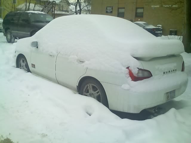
Woohoo the SUBIE LIVES!!!
I was expecting 19" inches of snow and temperatures in the single digits for a couple of weeks. Considering global warming, it won’t be quite that bad.
[IMG]http://img.photobucket.com/albums/v108/baileypicks24/011709_15401.jpg[/IMG]:unhappy:
DUDE! What is that white stuff all over the place?
When I was a kid, I used to walk 8 miles to school in 2 feet of snow.Fixed.
Fixed.
…uphill, both ways
.....uphill, both ways
When I was a kid growing up in the PA snowbelt, I lived on a private road and had to walk 1/2 mile through a valley to get to the bus stop, and the road usually wasn’t plowed that early in the morning.
So, I really did have to walk 1/2 mile through several feet of snow to get to the bus stop, and it was uphill both ways.
Not kidding.
It’s 7 degrees F at my parents’ house today.
They are predicting 2-4 inches so that means we’ll get 1 inch or 12. They said it could be “significantly more” if the storm is stronger than anticipated.
[QUOTE=Niner National;378111]They are predicting 2-4 inches so that means we’ll get 1 inch or 12. They said it could be “significantly more” if the storm is stronger than anticipated.[/QUOTE]
But the over-under of interest is not the amount of snow or ice. It is the amount of coverage. I mean how many times will Eric Thomas cut into Monday night shows to tell me what the “storm” has done in the last 4 minutes since he updated us last? How many updates will we get from the DOT salt silo?